
However, this shot of the launch preparations wasn't too bad...
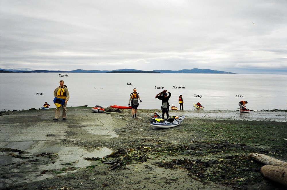
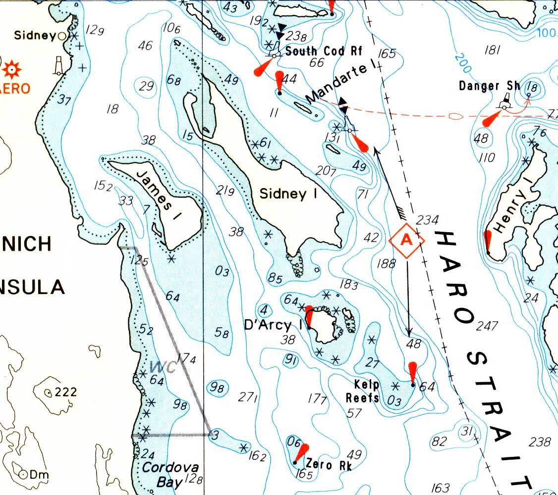
The decision was made to paddle a circumnavigation of James Island, a fairly straighforward proposition. The tide was on the ebb flow until about 11:55 am, creating a fairly strong current where the channel narrows on the west side of James. It was about here that Dennis and I decided to head off across to James and paddle around the south side of the island.
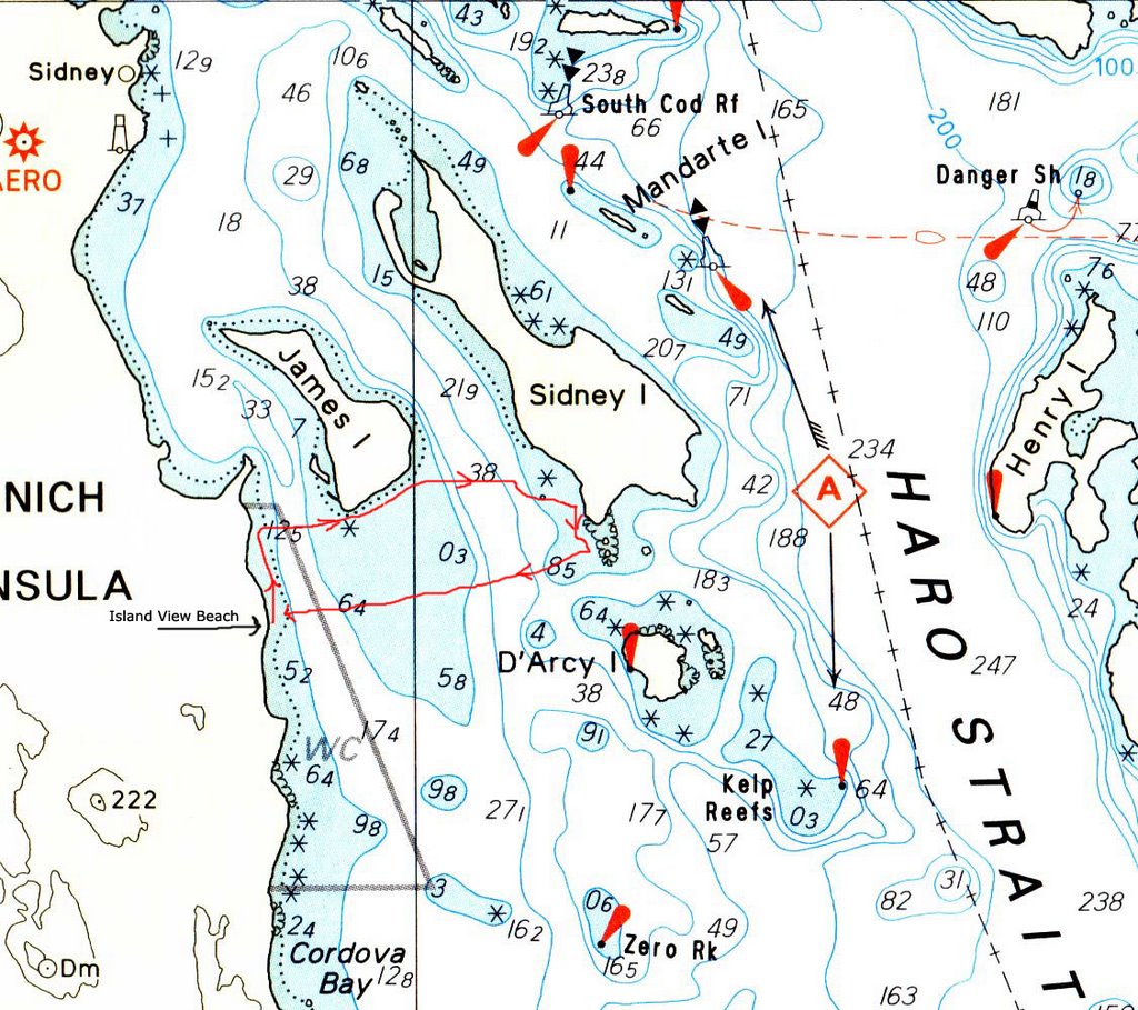 Our route wasn't really planned;there is a strong current running west to east along the beach on the south side of James Island, so once we made our way across, it was very simple to keep going. All you had to do was not paddle for a while and you were halfway down the beach without noticing it.
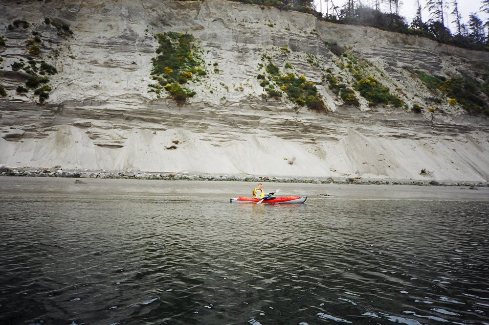
The silt/sand cliff is pretty impressive--not so much for being there, but for still being there. It looks like it should take about one rainstorm for the whole thing to end up at the bottom of Haro Strait.
Once we had let the current push us down to the east side of the island, it was a simple jump across to Sidney Island. We put in briefly at the south end of Sidney for a stretch--turned out that this was the same time that the rest of the paddle group had put in on the east side of James for the same reason.
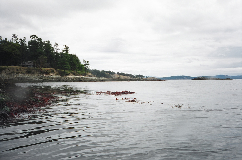 South end of Sidney Island
It was very tempting to make the trip over to Darcy Island--former site of B.C.'s leper colony. But right on cue (as Maureen had mentioned), the wind came up. Not that it was bad--a moderate offshore blow, but there was no telling how strong it would become, and it meant that we would be paddling back directly into it.
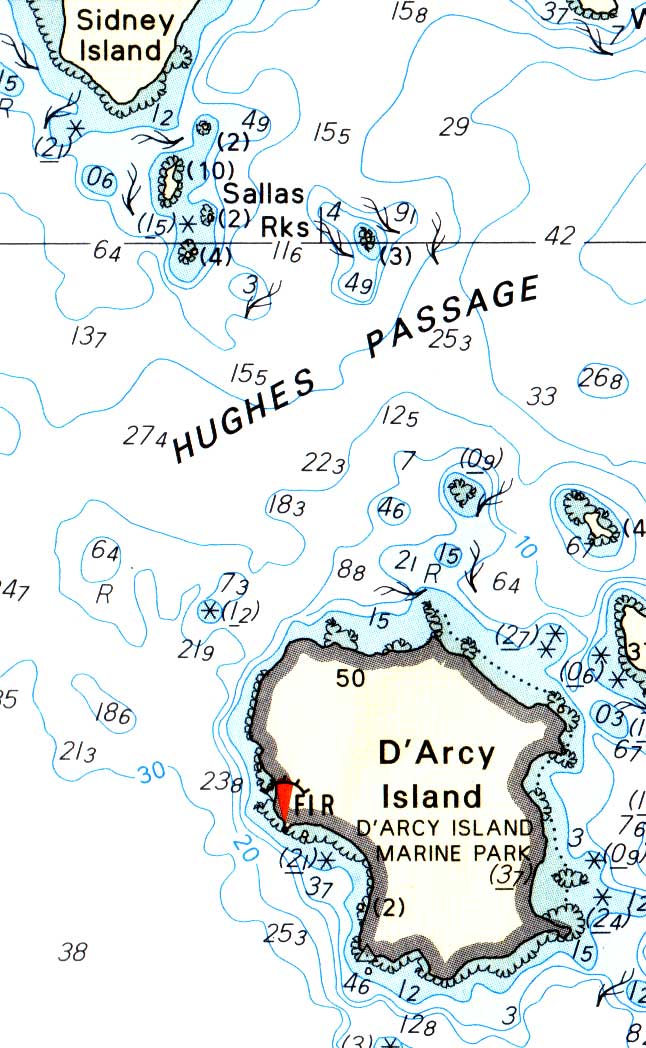
As we paddled slightly south to the Sallas Rocks, we noted that the distance to Darcy was a bit deceptive--like the approach to Sidney island, it looked as though the more we paddled, the farther it would be to our goal. Very very frustrating....
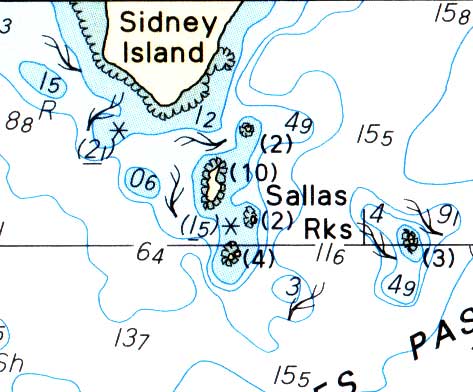
But as we passed the first of the rocks--and fairly large they are too at low tide--our paddling and talking startled a number of seals basking. On the chart above, they would have been on the rock next to the (2) under the "S" in Sallas. And not one or two seals, but a couple of dozen. Some stayed put, but most hit the water and then these large heads popped up to check us out. They watched us, we watched them, and finally we blinked, and headed back to the launch point.
The paddle back was about 7 km (about 4 miles) and took us roughly one hour and forty-five minutes. We kept looking for the other six paddlers--who, it turned out, made it back to the beach about ten minutes ahead of us--and although we had a clear view of the south end of James Island all the way back, we never saw the rest of the group. This, I think, was an important lesson about visibility on the water....
No comments:
Post a Comment