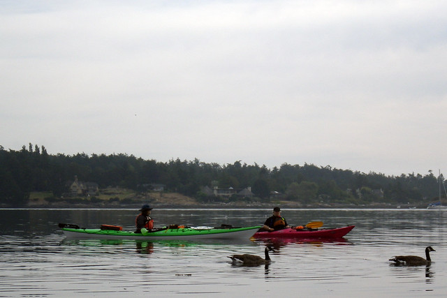
What a joy it is, to plan a paddling trip, and finally be able to do it! For a couple of years now, I've been hoping to paddle on the Red Deer River between the cities of Red Deer and Drumheller. For one thing, this stretch of river is apparently the most congenial for novice kayakers -- and when it comes to white-water kayaking, I'm a novice. The
video that Bernie posted of me paddling a little rough water on
the Sooke River shows the only place I've put a kayak in a bumpy river.
 |
| See that tiny dot near the middle of the river by the bluff? That's me! |
For another thing, I am fascinated by the study of dinosaurs. And the Red Deer River is a natural highway for the study of dinosaur fossils! The
Royal Tyrrell Museum in Drumheller is one of the world's finest.
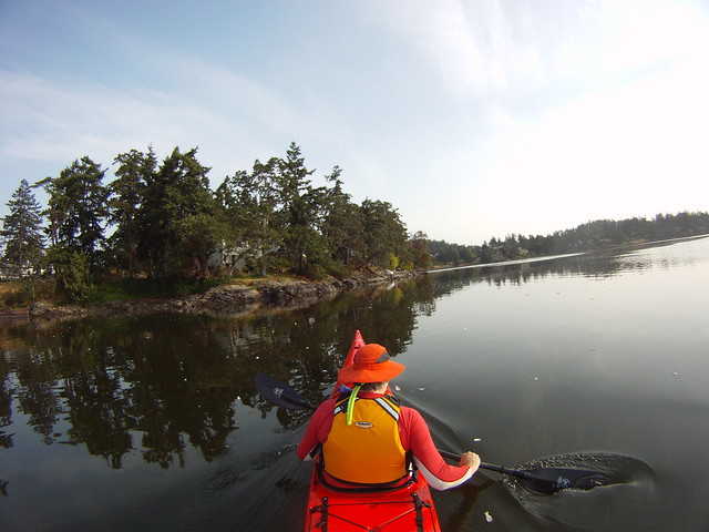
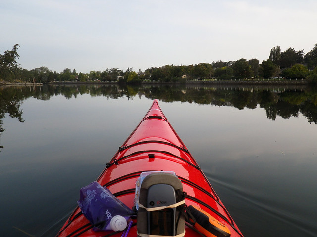
Best of all, the Advanced Elements kayak that I used was ideally suited to the river, the travelling, and the paddler. I used their
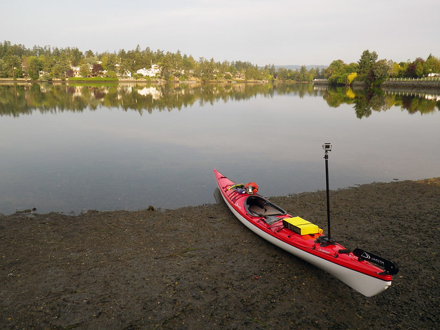
Expedition model, a 13-foot inflatable kayak that can travel on airplanes without being classed as over-size or over-weight baggage. (Hint: Though the bag will allow one to stuff a doublestroke air pump, a bilge pump, a throw bag, and a four-piece paddle in with the kayak, the bag will then weigh well over 50 lbs. Unless you get a nice friendly attendant at the counter, the airline will add an over-weight baggage charge.) This is a kayak I commonly take on city buses, by strapping the bag to a luggage roller like it is in the photo below.
For the last few years, I've been reading all kinds of resources on paddling the Red Deer river by canoe or kayak. There's a very helpful resource online at
Paddle Alberta, with information on several rivers. Their
page on the Badlands section of the Red Deer river is terrific! I printed it out and used it as my primary information source. I also picked up a copy of the Middle Red Deer River Map at Mountain Equipment Co-op. There are also several promotional websites from park programs or chamber of commerce sites and the like, such as
this.
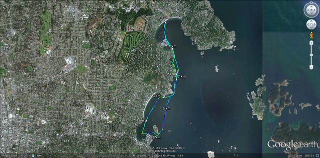
Here's an image from the Paddle Alberta website on the Canadian Badlands, showing their map of my planned trip:
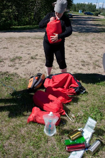
All that preparation meant that I had a good idea what to expect on this stretch of the river, between Content Bridge and Drumheller. I borrowed a small tent from my daughter Lila, and brought my summer-weight sleeping bag. A tiny air mattress made the ground very comfortable! The yellow drybag you can see in the photo above held my food... about three times what I needed. Hot weather = loss of appetite.
 |
| Plenty of water bottles on this trip! |
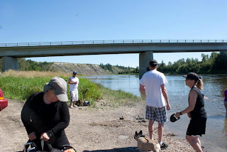
Lila and her friend Sapphira were my ground crew for this trip. Sapphira drove us from Edmonton to Red Deer to visit with the BatBaby (ask Lila about her goddaughter!) and fill my water bottles. Following the river for several miles, we arrived at Content Bridge campground.This is a good point to start a quiet paddle on the river, as there are several riffles and very easy rapids just downstream from the city of Red Deer. I didn't want the challenge or the longer trip this summer. All reports say that below this bridge, there's only the one riffle at Backbone. The $5 parking and launching fee at the campground wasn't out of line. After watching me launch, Sapphira and Lila were able to get something to eat at the burger stand.
 |
| The colourful dots on the river are people floating downriver for about a mile on inner tubes before getting out here by the bridge. |
At the shore, there were waders and dogwalkers galore who stopped to take a look at the kayak. It only takes about ten minutes to set it up and inflate it. Today I stuffed in the various drybags and pulled them out to try them in different arrangments, at least three times. This time was spent, as usual, answering questions about the boat and my gear. The technical aspects of the inflatable kayak fascinate some people. Others are concerned whether I am wearing a life jacket and carrying all the right safety gear. Even those who don't know what a throw bag is are reassured to see that there is one on my boat's deck! The
SPOT device clipped to my PFD made a big impression, as I pushed the button to send an OK message with my location to my friends.
 |
| The SPOT sent a message to friends with a link to this map of my location online. |
Sapphira proved a conscientious ground crew at this point. "Where's your bailer?" she asked, and I showed her the bilge pump. Several questions later, she was satisfied with my preparations. A quick goodbye to my ground crew and I climbed into my kayak with feet that were wet but not muddy.
I headed off into the hot afternoon, immediately feeling much cooler on the water than on the shore. Hurray!
I think that feeling of "hurray!" was sustained for the next four days.
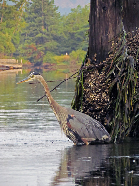
The shoreline was much greener than is common for August, but that was because of all the rain this summer. This part of the river passes through Aspen Parkland. Most of the trees and brush growing along the banks were willows... low and scrubby or twenty feet tall and bushy. Along parts of the bluffs there was sagebrush growing.After a few turns of the river that was headed southward, there were gusts of good smell on the breeze. Around another bend was a big stand of pine trees, putting out that good scent. So fresh!
There was one deer standing along the shore that first afternoon, and a second deer the next day. I think they were both mule deer, as they were rather large, with dark ears.
The tension went out of me as I realized that the gentle current really was easy to handle. I practised crossing the river, doing ferries and sideslips, getting used to handling the loaded kayak in the slight current. The only time I nearly tipped was when I leaned back to watch an osprey soaring. Suddenly, it dove down and grabbed for a fish. If the osprey caught anything, the fish was too small to see with my bifocals tucked away in a drybag.
That first afternoon, I was worried about being too slow on the river. I didn't stop for dinner till I camped, and I didn't stop to camp until after making my way through the only riffle on this part of the river. It didn't sound like a "riffle" when I was approaching it. To be honest, it sounded very noisy indeed. The map and river guide both said to take the left channel around an island. The river was very shallow here at Backbone Riffle, where Anthony Henday and a party of First Nations guides crossed the river in 1745. Most of the channel was knee-deep or less. The water ran noisily over rounded rocks. At one point, the boat bottomed out and got hung up on a rock... but the rock seemed pretty round. I was able to hop the boat along and off the rock in a few tense moments. The rock didn't leave any visible scratches on the bottom of the hull.
That was the only place where the current felt strong. Everywhere else, the current kept up a steady gentle push. In a few places it was very easy to paddle a short way upstream. If I didn't paddle, the boat would gently drift sideways and I could look back upriver to see what the weather might be doing.
The prevailing winds in central Alberta come out of the north-west. A cloud bank slowly moved in over a couple of hours, showing me that a weather front was approaching. When I heard a rumble of thunder, I turned again to see sheet lightning flashing from cloud to cloud, and rain slanting out of a cloud to the north. There would be rain here soon, within half an hour! It was time to camp.
 |
| This map shows my first day's travels, on a satellite photo of the area. |
Luckily, at that bend in the river was a perfect spot to camp: a shore easy to land, a raised bank with willow trees where I could put the tent, and a high bluff above and across the river to take most of the lightning. There was a cabin among the trees, with a firepit that smelled of recent burning, but no one was around when I called out my hellos.
There was a lot to get done in the next few minutes. I hauled the kayak up on shore and pulled out the bag with the tent. Up it went in a few minutes -- not bad for the first time I'd put up this particular tent! Inside went my drybags with food, sleeping bag, and clothes. I lifted one end of the kayak, then the other, onto the bank in case the river level rose suddenly, and rolled the kayak over to keep out the rain. The nearest tree to tie it to was sixty feet away. based on tying a 15-foot painter to a 50-foot rope from my throw bag. It looked like the kayak was a dog tugging at the end of a very long leash!
Just as I got into the tent, the rain started pattering down. It was only a short squall, but I was inside and dry and snug. There was hot water in my thermos, so I made instant mashed potatoes and drank cocoa, and felt good. Lightning and thunder were no problem here. By the time it was dark, everything was quiet.
Next morning, I didn't rush to take down camp. The map seemed pretty clear, and I thought the Trenville Campground would be about an hour downstream. It was a good idea not to rush. The day was bright and clear, and when the sun finally rose over the bluffs the air quickly got hot. By then I had my gear packed up and the boat back at the shore, without rushing or trying to lift everything at once. Some people use up all their enthusiasm in a lot of heavy lifting and rushing around.
 |
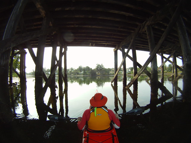
| Bridges are so visible from the water and shore! |
When Trenville Park campground came into view, I landed. I had to guess; they don't have a sign at the shore announcing the campground. This photo is from the Content Bridge, but it gives a sense of the green shore and the people cheerfully coming down to the water's edge... though the bridge at McKenzie Crossing is out of sight almost an hour downstream from Trenville Park!
I was really impressed by the campground at Trenville Park. The restrooms were well-maintained, and it looks like a lot of RV and truck campers like to stay here. The pay phone worked, and I was able to check in with Bernie. Two important points got confirmed: I had successfully navigated the only rough water on this part of the river, and my wallet was left in Sapphira's car. No fear though -- I had a doubloon tucked into my bra, so I wasn't broke.
Cheerfully, I headed off for what promised to be a day of exciting topographical changes. The river passed under McKenzie Crossing Bridge and into Dry Island Buffalo Jump Park. It was amazing to watch the transition from Aspen Parkland to Badlands, and to see the layers in the soft bluffs that began to tower overhead. Millions of years ago, all this area was the bottom of a shallow inland sea that geologists call the Bearpaw Sea. The great black line I could see across the hills was marking out the boundary between the Cretaceous Period and the Triassic. Below that line were dinosaur bones. Above it, there were no more fossils of dinosaurs.
Any vegetation was sprinkled over the rough ground like an afterthought. Groves of pine trees continued, but were broken up by more bare ground as Badlands began to predominate. I began to smell and see herds of cattle grazing along the river banks. There were black and red Angus cows with their blocky, square calves, as well as Herefords and Charolais... marvelous to see their various colours and hear their quiet calls to each other. Through the scrubby willows along the shore, the cattle would push through to come down to the water and drink.
The map of my second day's travels shows that I went through Dry Island Buffalo Jump Park and camped near Tolman Bridge. The spot marked 4 on the next map shows where I looked at the buffalo jump and the mesa called Dry Island. It's impressive if you know what you're looking at; a cliff becomes a cliff where the buffalo would fall, not just a crumbly bluff. And below wasn't just a jumble of muddy crumbles mixed with old bones. It was the place where people would have been waiting with spears to finish off the buffalo, after the runners had driven them off the cliff. Falling a hundred feet onto its head doesn't kill a buffalo. But the fall does stun it or break a leg, so it's easier to kill. And then, there's lots of water here from the river and a nearby stream, for the butchering and cooking. Eroded hillsides looked like dinosaur bones sticking out of the clay and sand. Other eroded bluffs along the river banks have round faces like Mount Rushmore, and others have sharp broken edges like profiles of faces looking up-river at the Buffalo Jump.

The point on the map marked 5 is where I stopped at a stream with a sandbar, to cook my dinner. I realized that for two days I'd eaten very little. Big bowl of pasta with tomato paste and parmesan... yum! Two big red Angus cows came along the shore to investigate what i was doing. You can also see this map on a satellite image just below, showing the transition from green hills above the river valley to badlands. Point 6 is where I decided to camp for the night, stopping about 7 pm instead of 8 pm like the day before. No need to rush. I passed four groups of young people or families on the river that day, drifting along on inner tubes or inflatable dinghies.
 |
| There was less green around me as the day went on. |
When I set up camp, I figured that the Tolman Bridge was about an hour away, but it was only ten minutes downstream. This shore was a good place to camp, though: shallow place to beach the kayak, bank to camp near trees, and a high ridge across the river in case there was lightning like last night. The weather was turning cloudy and threatening rain. There was still traffic on the river, though. Two more inner tube parties drifted by, looking to be picked up at the Bridge, and two girls on horses rode past my camp. Luckily, nobody came by when I went wading in the river and scattered tiny fishes with my splashing.
I sat in the tent, mosquitoes safely OUTSIDE, and opened my thermos for hot water to make some mashed potatoes and later some hot cocoa. Nice to have the sound of birds in the trees, and to have trees overhead in case a storm came by. That night, thunder woke me seven times before I lost count of the crack and BOOM overhead.
That morning, I had to wash gumbo mud off my feet and sandals when launching. No way I wanted to paddle around with a pound of mud clinging to each foot! The kayak was still rather grubby inside, but at least it wasn't slimed with clay. This photo shows me trying to fit the luggage roller in, before unzipping the back of the kayak and putting the roller under my big drybag. Heavy things go on the bottom whenever possible!
The map of my third day's travels shows that I went through the Badlands, reached Starland Campsite and camped downstream from the Morrin Bridge.I woke early to the sound of wind. No need to get up right away, so I lay around letting the day's weather get better. Realized that I was still underfed, so I boiled water and made a big bowl of oatmeal with raisins and brown sugar. The sun finally came over the ridge and the day baked bright and calm. A big white pelican flew downstream. Ducks on the river today, all day, quiet and fishing and flying.
Just below the Tolman Bridge, I found a path to the campsite. Their watertap was a "boil to drink" tap, but a nice couple in a camper gave me a litre and a half of drinking water. And here, i saw two rabbits! Little cottontails that ran when they saw me. In places, the river feels like it's in a canyon. This is the most isolated part of the river... there are cattle grazing on ranchlands, but no cabins visible from the river.
Here's that map on a satellite image! I had to stop at Starland Campgrounds for water. This was a cool day, but on a hot day it's easy to need twice as much water as expected. Lila loaned me a waterbag, and Ben gave me a new metal water bottle, so I had plenty of containers.
 |
| The brown and grey colours along the river bluffs were striking! |
The tea-coloured river kept moving along, and I often drifted rather than paddling. The river guide suggests to make this a short day. There was no rush. I kept an eye out for the island that would mark where to look for Starland Campground. Even though I stopped at their boat launch, I thought it was a rancher's water access and continued on. A kilometre down the river, I could see Morrin Bridge! Suddenly, I realized that I'd passed the only available drinking water place for miles. I was lucky to find that the current was very mild here, and I was able to paddle upstream for a kilometre back to the boat launch. Up a steep path, I found the campground. It was a nice, clean place, but hot and very open with fewer trees than would be comfortable for shelter. The grass was being mowed by a woman on a tractor, who didn't mind at all me filling a couple of my water bottles.
It was too early to camp, and I didn't have the fees for camping at Starland. I went on under the Morrin Bridge to look for two possible sites on the map. I wanted a place that had a good landing, room among willows and near trees for the tent, and a big ridge either above or right across the river in case there would be more thunderstorms. (There were no storms that night, but a very heavy dew and fog in the morning.)
The first place I'd picked had already been occupied by a party camping along the river. There were two adults and 6 boys and girls, all happy to be here. They weren't noisy, though, so I set up around the point, using a cattle trail to get up the bank for a place to put my tent. It was a good spot. The local beaver thought so, too! Several times that evening and the next morning, there was a loud slap! on the water as the beaver expressed some of his opinions about me camping there.
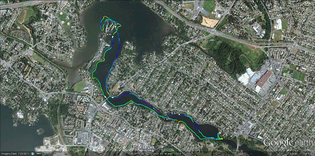
Morning was cool, and grey when I woke early. Fog filled the narrow valley of the river! I went back to bed with a Dick Francis novel and fell back asleep. The campers got on the river a little before I did, but I caught up to them a little above the Bleriot Ferry. There's a great sign on the river so that paddlers will know the ferry is ahead! Here's a map of my fourth day's travels showing that I passed the Bleriot Ferry, and arrived in Drumheller that afternoon.
And here's that last map on a satellite image:
 |
| Lila kept checking out these messages and realized I'd get to Drumheller before she and Sapphira were due there! |
What a good day this was! I took time to drift and float often. There was another mesa along this part of the river. I love how sounds echo off the mesas and bluffs.
A couple launched their red canoe, and for about two hours paddled a few hundred yards ahead of me. The last half hour, we paddled together and talked. This was their first trip in their new canoe! Their old canoe had been stolen a few years ago, when they left it on the beach in Drumheller overnight. A little riffle came up on the last bit of the river, and they insisted that I had to run it with them, as it was the most fun part of the day. They were right -- it was just bouncy enough to be fun! And then we pulled onto the beach in Newcastle Park in Drumheller.
(NOTE: Land here! There is no other place good for landing in Drumheller, as far as I can tell.)
The nice couple asked what I was doing with my gear now. I sent a text to Lila, and got a note back saying that she'd be in Drumheller that evening. Hearing that, the nice couple said that they'd give me a ride to the campground... could I watch their canoe while they went to pick up the vehicle they left at their launch point? Of course! And not only did the wife give me and my packed-up gear a ride to River Grove Campground, she waited to be sure I had a cabin rented. Awesome!
The cabin worked better than taking three separate campsites in different parts of the campground. I set up the tent on the deck, where it began evaporating dry from the morning's fog. Hand-washed all my camping clothes and hung them to dry on the picnic table. Put water to chill in the little fridge. Took out the doubloon and bought four big Freezies in the campground office. By the time that Lila and Sapphira arrived, the gear was all dry, and I'd found a little home-cookin' restaurant called
The Old Grouch Cafe two short blocks away that had plenty of vegetarian food for Sapphira and wheat-free food for Lila. We took takeout and went back to the cabin, talked till late, and slept like logs. Well, I did. When Sapphira left the tent where she'd been sleeping on a stack of air mattresses to come through the cabin in search of the bathroom, I didn't hear a thing.
I'm glad to say that by the end of this trip I hadn't pulled any muscles or strained anything. Except maybe the balls of my feet. I'd been pressing my sandals pretty hard against the footbar of the kayak for four days. Kept wanting to feel connected to the boat, and be aware of how it was moving in the current.
A terrific river trip! Glad to make the run at last.